Ordnance Survey Triangulation Pillar (Trig Point) & Base


Ordnance Survey Triangulation Pillar (Trig Point) & Base
Published 2020-03-29T10:30:17+00:00
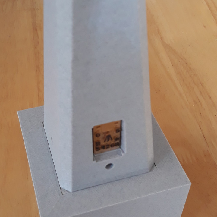
This is a model (1/10 scale) Of a British Ordnance Survey Triangulation Pillar, or Trig Point as they are more commonly known.
Over 6500 of these pillars were constructed an prominent mountains, hills, places etc. to allow the accurate mapping of Britain in the 1930s & 1950s. Many survive to this day and are a welcome sign for walkers, as a sign that they have reached a summit! The highest Trig Point is on Ben Nevis and the lowest is in Norfolk, -1 meter below sea level.
Many have been destroyed due to erosion, building works etc.
Most of the pillars followed a standard concrete design by Brigadier Martin Hottine. It is Hottine's design I have model here.
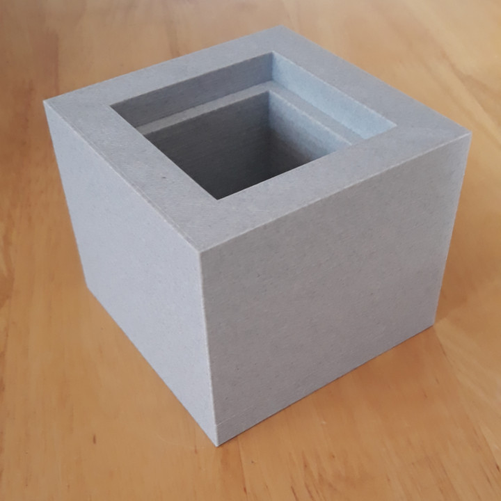
The base is also to 1/10 scale and if printed, it can be used to turn the Trig Point into a small keep-sake box, maybe for rings etc.
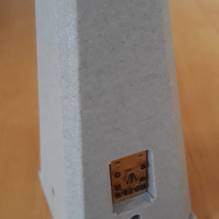
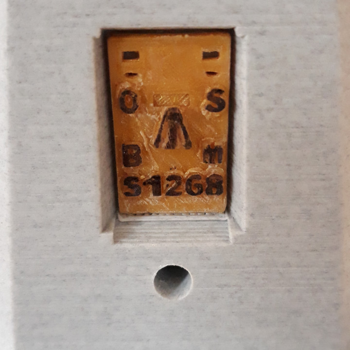
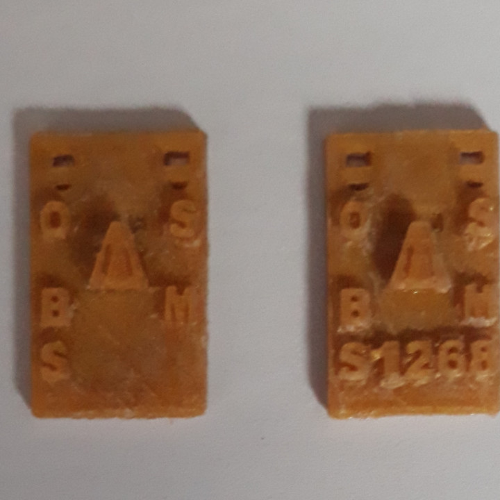
I have also modelled a few differing 'Flush Brackets' which fit into the recess of the pillar.
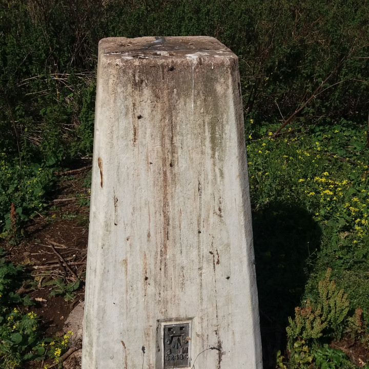
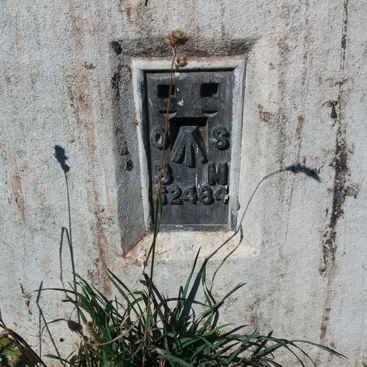
The picture of the 3d printed model shown is the one from my local hill, Liddington.
and the photos of the real Trig Point are of the one on Steep Holm Island in the Bristol Channel.


Print the base & pillar at 0.2 resolution to give a slight rough effect - The real things were concrete after all!
Print the Flush bracket at slow speed and at 0.1 resololution to ensure the detail shows well.
The pillar may have an issue with two of the Sight holes, which printed slightly eliptical on my printer. If this happens, just gently run a 5.5 to 6 mm drill in them until it looks right.
Infill density:-
Use 20% for the base & pillar and 100% for the flush brackets.
Printing time for the whole thing was around 19 hours.
| Date published | 29/03/2020 |
| Time to do | 18 - 21 minutes |
| Dimensions | 90x90x195 |
| Support Free | YES |